John Muir Trail 2013
|
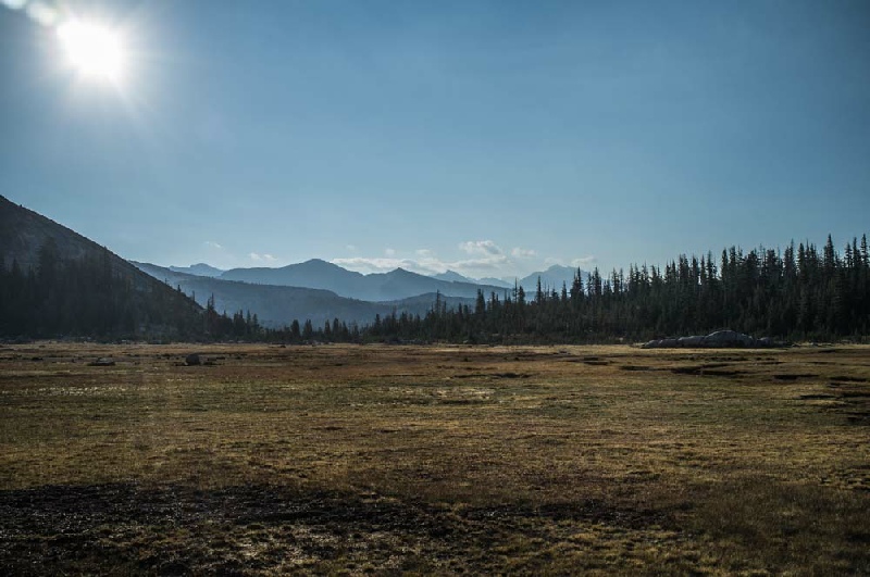
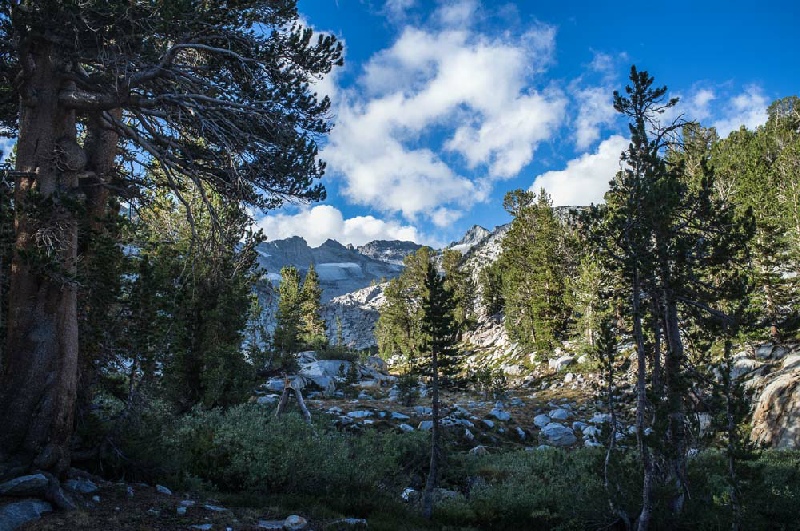
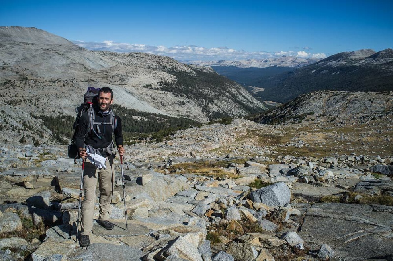
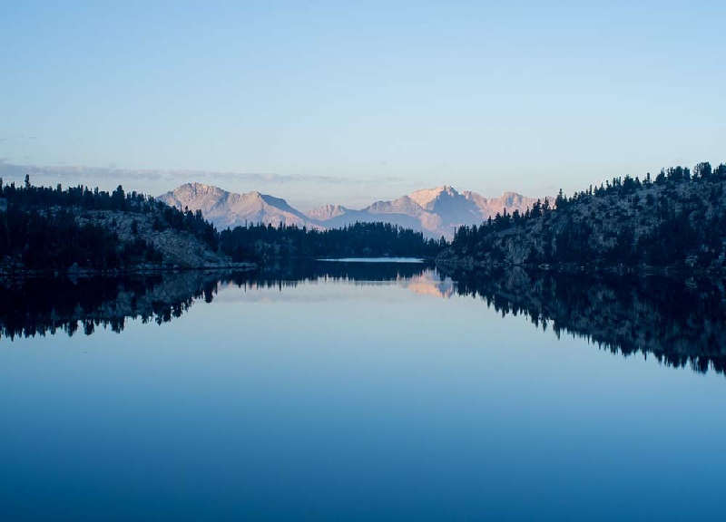
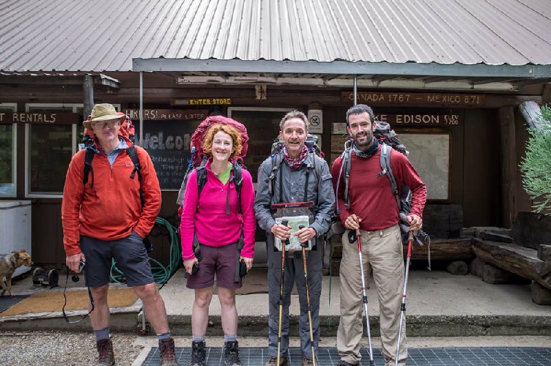
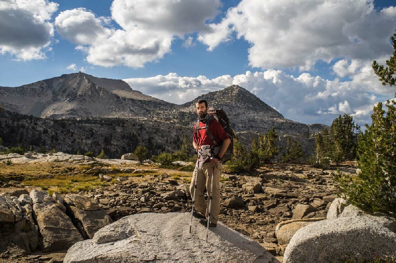
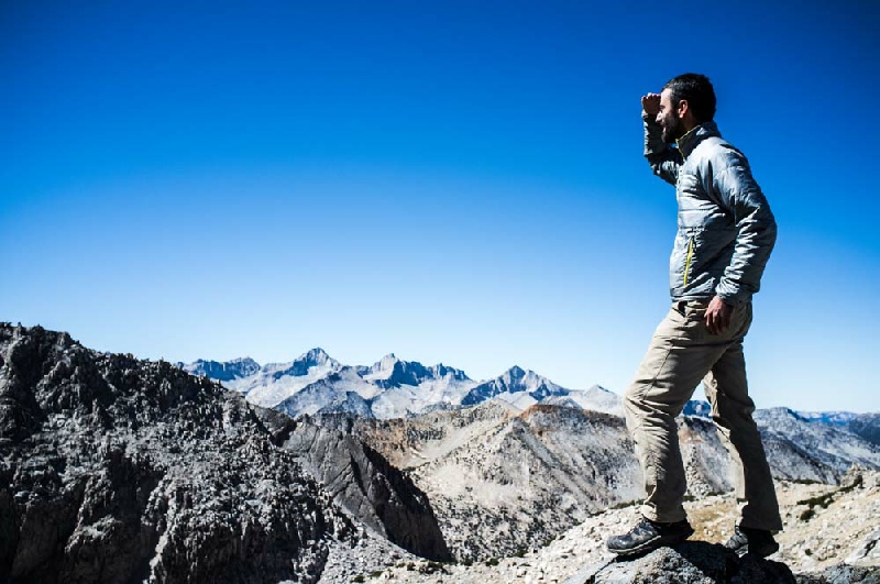
The John Muir Trail The John Muir Trail, named after the famous early environmentalist, runs along the spine of the Sierra Nevada range of mountains in northern California. The route stretches 211 miles from the Happy Isles trailhead at Yosemite to the summit of Mount Whitney. The beautiful Sierra Nevada were referred to as the "Range of Light" by John Muir, and contain an incredible diversity of scenery. This is many peoples' favourite hike anywhere in the world. The trek is of varying heights, taking between 2- The trail reaches 4,421m at the top of Mount Whitney, and averages a shade over 3,000m. David did the trip in the company of Mike and we were joined from Red’s Meadow onwards by Vere and Fionn. Further pictures are here. A DVD of the John Muir Trail is available. | |
|
| |
|
Tips for the JMT
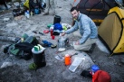
There are masses of websites that give a huge amount of information on how to get
permits, what food to take and re- A video of the trip has been produced which would help anyone planning to walk the John Muir Trail. Please email David if you want a copy. (nominal £10 charge to cover costs and postage.) |
|
|
|
|
|
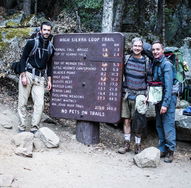
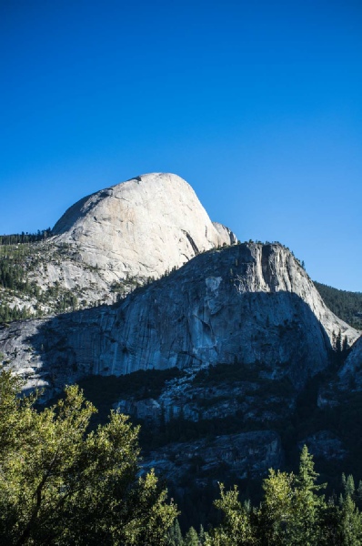
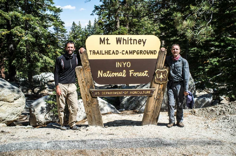
Day 1 Happy Isles to Sunrise High Sierra Camp Total distance of day 16 miles Total ascent of day 5000ft After an enjoyable afternoon exploring the Yosemite valley floor, we had a good night's rest at the Backpackers Campsite. After an early start, Martin, Mike and myself set out on the road to the Trail Head. The sign at the beginning of the John Muir Trail was photographed and then it was "heads down" for the climb to the top of the Nevada Falls. The pack was considerably lighter than on my previous JMT trek and this helped enormously, easing the pain of the first ascent. After a couple of hours, it was very sad to hear Martin say he was having problems with one of his calf muscles and he had decided to go back to the valley floor. At the Half Dome junction we carried straight on towards Sunrise Creek. The series of switchbacks later on in the day seriously tested our reserves and it was after 6 in the evening before we made the Sunrise Sierra Camp and set up the tent. A long and tiring day. |
|
|
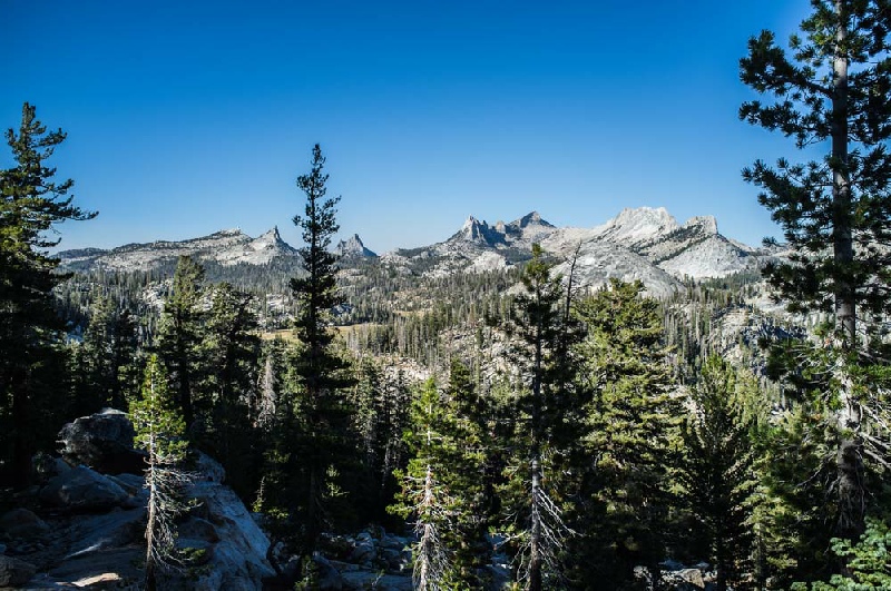
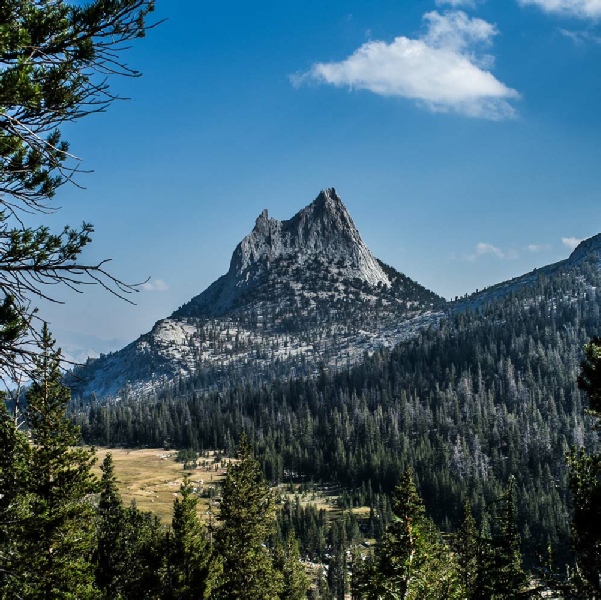
Day 2 Sunrise High Sierra Camp to Upper Lyell Canyon Total distance of day 19 miles Total ascent of day 1600ft Getting into the rhythm of the trail is a bit of challenge for the first few days so it took us quite a while to get packed up and ready to start the day’s walking. The first part of the day involved the gentle climb up Cathedral Pass and then dropping down into Tuolumne Meadows. The Grill in the Tuolumne village does a brilliant bacon and cheese burger which helped the calorie intake enormously. A very pleasant afternoon was spent walking along the Lyell Fork River until the path started to climb which is where we camped for the night. |
|
|
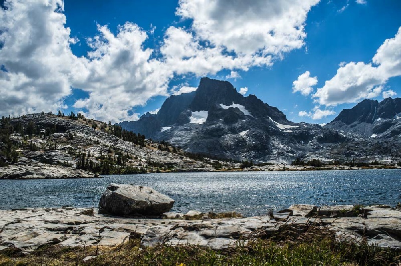
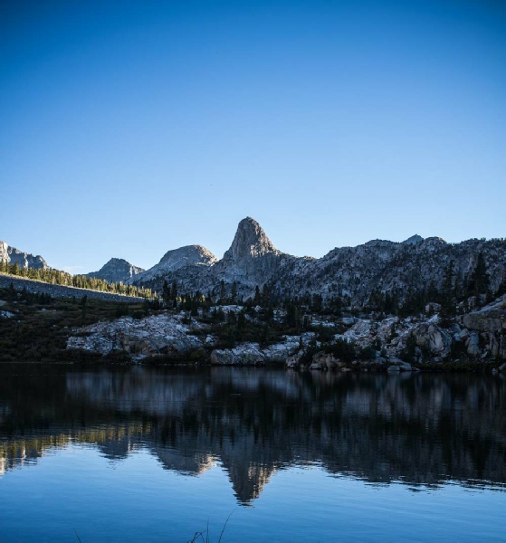
Day 3 Upper Lyell Canyon to Garnet Lake Total distance of day 14 miles Total ascent of day 2500ft An uneventful night was had with no bear issues. The initial part of the day included the ascent of the first serious mountain pass of the JMT, the Donohue Pass. The views from this pass were stunning and gave a window into the joys to come further along the trail. After a inconsequential second pass of the day, Island Pass, the wonderful Thousand Island Lake was passed. A ranger passed us at Ruby Lake and asked for the only inspection of our trail permit on the whole trail. She very kindly gave us some information on a good place to camp near Garnet Lake using a side trail just before the drop down to the Lake and camping near the top of the Lake, under the Ritter range of mountains. After making our way to the campsite, we then had our first swim of the trip in the cold but wonderful water of Garnet Lake. |
|
|
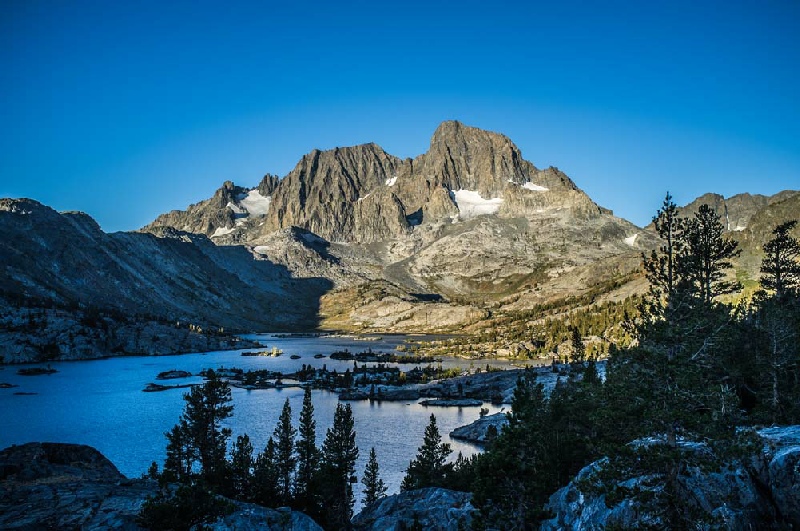
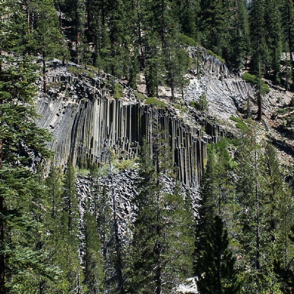
Day 4 Garnett Lake to Reds Meadow Resort Total distance of day 16 miles Total ascent of day 2000ft The day was a joy with the JMT threading it's way through some of the best mountain/lake country on the whole of the Trail. Garnett Lake in the early morning is flooded with wonderful light and amazing views of the surrounding mountains of the Ritter range. Shadow Lake was passed early in the morning with stunning reflections in the crystal clear water. Mike decided to check out the water in the lake with a swim as well. A fast long wooded descent saw us down to the Devils Postpile National Monument and a view of the basaltic column structures. Reds Meadow Resort was the next port of call with the very welcome showers and the excellent restaurant. |
|
|
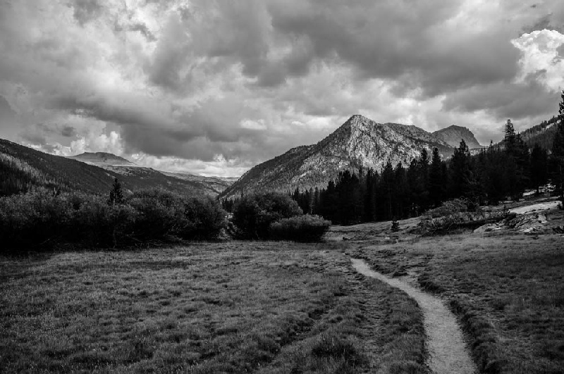
Day 5 Reds Meadow Resort to Virginia Lake Total distance of day 16 miles Total ascent of day 2000ft After a good breakfast in the restaurant the climb towards Deer Creek was a bit of struggle with such a full stomach but the red pumice cones added interest to the climb. The rest of the day was easy with gently gradients and wide open views especially near the picturesque Purple Lake until the steep climb just beyond the Lake. The day ended by setting up the tent at Virginia lake and a great swim to follow. |
|
|
Day 6 Virginia Lake to Vermillion Valley Resort Total distance of day 18 miles Total ascent of day 2000ft The rocky landscape around Virginia Lake was replaced by a lush woodland near Tully
Hole. The next obstacle was Silver Pass which was climbed without too much pain amongst
some very inspiring rock scenery. The long zig- |
|
|
Rest Day - A day of chores with clothes being washed and the food supplies sorted out. The logistics of the rest of trail were also discussed and great assurance from Vere that it would be no problem, it was decided that we would attempt to do the remaining trail to Mount Whitney in 8 days. |
|
|
Day 7 Edison Lake to Heart Lake below Selden Pass Total distance of day 16 miles Total ascent of day 3600ft The thought of repeating the trudge across Eddison Lake floor filled all of us with
dread so it was with great relief that we were offered a lift by John to the Bear
Creek Trailhead in his very impressive pick- |
|
|
Day 8 Heart Lake below Selden Pass to McClure Meadow Total distance of day 16 miles Total ascent of day 2000ft The day started with rain and it continued to rain of and on all through the day. The Trail headed southwards along the very beautiful San Joaquin Valley to enter the Kings Canyon National Park. At Franklin Meadow, a major fork in the trail was reached and the substantial ascent into Evolution Valley brought us to the river crossing at Evolution Meadow. The path on the northern bank of the river then gradually climbed to the very lush McClure Meadow. The rain was very heavy as we set up our camp but fortunately it stopped at around 6 in the evening to allow wet tents and clothes to dry out before the next day. A very memorable evening was spent gazing up at the wonderful panorama of the cirque of mountains. |
|
|
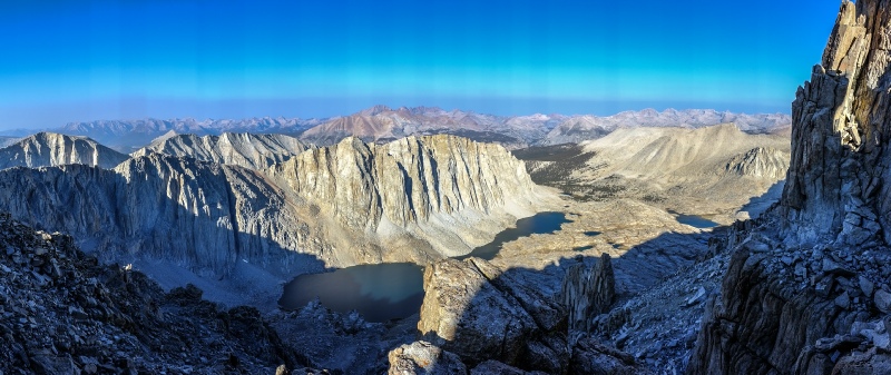
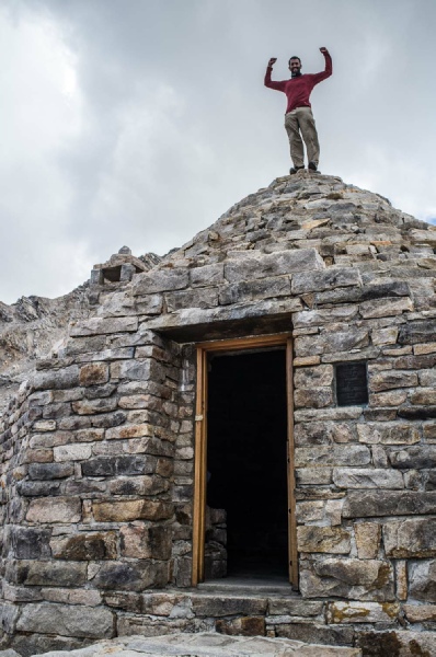
Day 9 McClure Meadow to Le Conte Canyon Ranger station Total distance of day 17 miles Total ascent of day 2500ft Today's route ascended the Muir Pass. Standing at 11995ft, this was the highest point so far on the Trail. The high point on the pass is marked by a shelter built by the Sierra Club in 1930 for emergency use only. A series of wonderfully clear lakes were passed on the way to the top of the pass including Evolution, Sapphire and Wanda Lakes. The shelter was reached and pictures were taken of members of the party perched on the top of the shelter. After the pass we entered the barren, impressive and fragile high mountain landscape
of the southern JMT. A steep descent lead to the tree- |
|
|
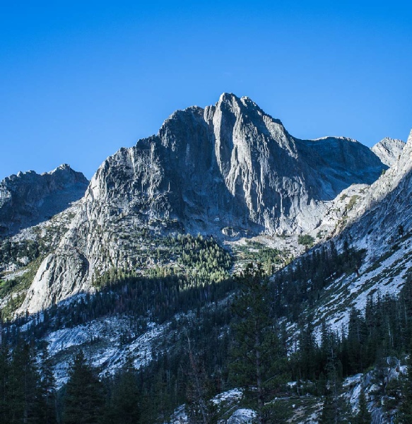
Day 10 Le Conte Canyon Ranger to campsite below Mather Pass Total distance of day 16 miles Total ascent of day 4100ft The day started with the long and gentle descent down Le Conte Canyon. This area
is a true high spot of the JMT with soaring granite cliffs stretching the length
of the Canyon. At the trail junction, the JMT branched left to the east to ascend
the valley in the direction of the Mather Pass. After Deer Meadow, the zig- |
|
|
Day 11 Campsite below Mather Pass to Dollar Lake Total distance of day 19 miles Total ascent of day 3300ft After a good night, eventually the tree- |
|
|
Day 12 Dollar Lake to the tree- Total distance of day 15 miles Total ascent of day 3000ft Arrowhead Lakes were passed early in the morning to finally reach the most wonderful
spot on the whole of the JMT - |
|
|
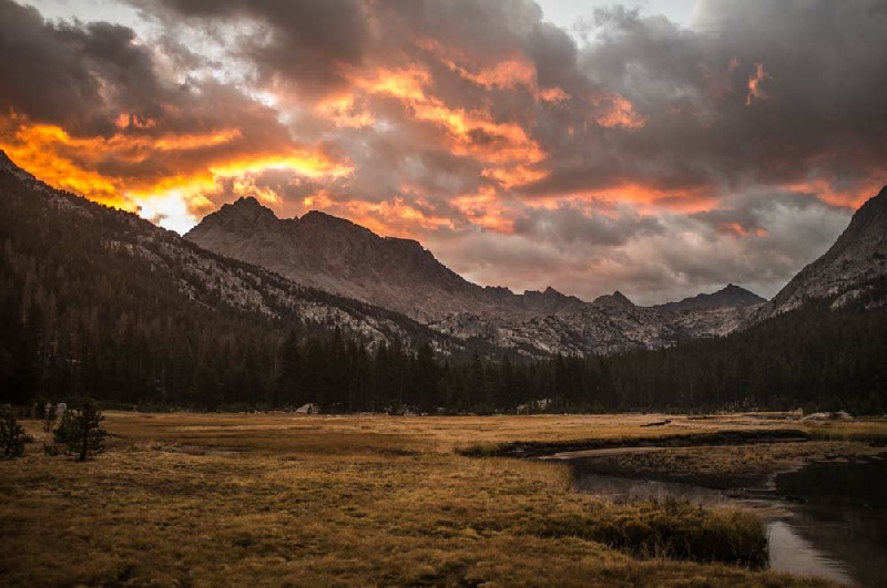
Day 13 The tree- Total distance of day 19 miles Total ascent of day 3900ft The ascent of the Forester Pass was accomplished early in the morning without too much pain. After taking plenty of photographs, there now followed the incredibly steep, engineered descent down the almost vertical face of the mountain. The rest of the day was a relatively gently walk to Guitar Lake, nestled under the final destination of the John Muir Trail, Mount Whitney summit. A fine mix of woods and meadows kept up the interest levels. A memorable sign was passed on the way indicating 8.3 miles to the top of Mount Whitney. The number of trekkers passed was increasing all the time as we got nearer to Mount Whitney with summiteers returning from their successful expeditions. Finally Guitar Lake was reached and the last camp of the JMT was set up followed by a very wonderful sunset. |
|
|
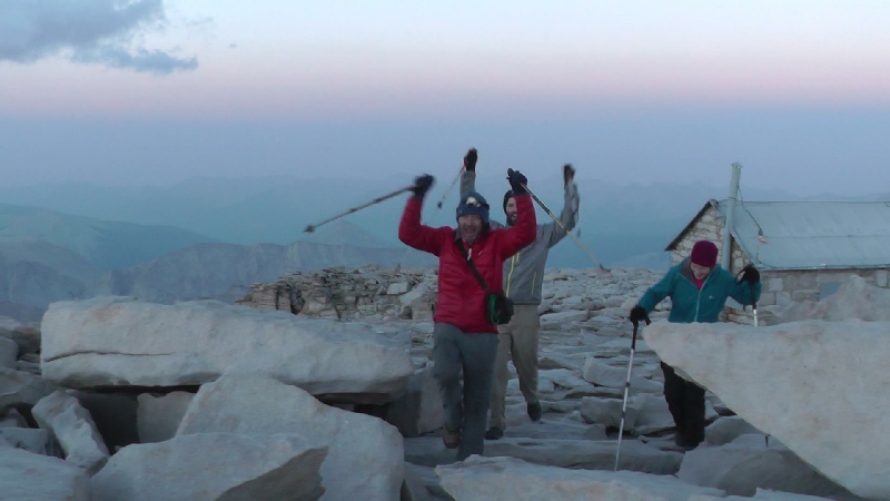
Day 14 Guitar Lake to Whitney Portal Total distance of day 15 miles Total ascent of day 2900ft The climb started at about 3:00 in the morning with a quick ascent to reach Trail
Junction. At this point the rucksacks were left and the final 1000ft of climbing
was accomplished with a great feeling of lightness. The summit was reached just as
the sun was appearing through a layer of cloud - The trail was complete with again some truly wonderful memorable times. The practicalities of getting back to San Francisco then loomed large in our thoughts but we need not have worried since a lift was gratefully accepted to Lone Pine and where after a night in a motel we boarded a bus bound for Reno Airport to pick up a hire car. |
|
|
Guides, Maps and Useful Sites Tom Harrison Maps for the John Muir Trail The complete guide to the John Muir Trail by Alan Castle |
|