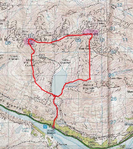
the Cruachan Hills
A magnificent group of hills bounded by Loch Etive, Glen Strae and the Pass of Brander,
offering the impression that they are surrounded by great sea lochs. The sea-
|
Ben Cruachan |
1126m/3694ft |
| |
|
Stob Diamh |
998m/3274ft | ||
|
|
| ||
|
date climbed |
22/05/08 |
time taken |
6 hours |
|
distance |
14km |
ascent |
1490m |
|
OS Map |
Landranger 56 |
Weather |
Sun and good visibility |
|
Starting point : Visitor centre beneath the Falls of Cruachan | |||
|
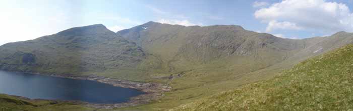
After a bit of fumbling to sort out the right way of access to the hillside I started the day by going under the tunnel by the train station and then making my way up to the Cruachan resevoir. The day was clear and had every indication of staying that way. The climb to Ben Cruachan's summit is long but the breathtaking views were well worth the effort. Loch Awe stretched away into the distance and the sea beyond was sprinkled with the outlines of the Islands. Eastwards, ripples of mountains stretched out and to the north Glencoe and The Ben beckoned. After a welcome break, the skyline was followed round to Stob Diamh, the second Munro of the day. No problems were encountered on the pleasant descent over Stob Garb and down to the resevoir. A great day's walking. |
|
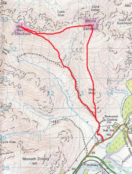
Beinn a'Chochuill |
980m/ 3215ft |
|
|
|
Beinn Eunaich |
989m/3245ft |
|
|
|
date climbed |
24/05/08 |
time taken |
5 hours |
|
distance |
13km |
ascent |
1190m |
|
OS Map |
Landranger 56 |
Weather |
Fair with mixed visibility |
|
Starting point : B8077 GR 137288 | |||
|
A relatively easy day that was helped by the hydro track that winds it way high into Glen Noe. This gives easy access to the grassy slopes connecting Chochuill and Eunaich and onto the summit of Beinn a'Chochuill. Broken clouds gave tantalizing glimpses of the wonderful sight provided by the northern slopes of Ben Cruachan as well as the hills surrounding Loch Etive and beyond. After dropping down to the high bealach, Beinn Eunaich was climbed directly to the summit cairn. |