the Mamlorn Hills
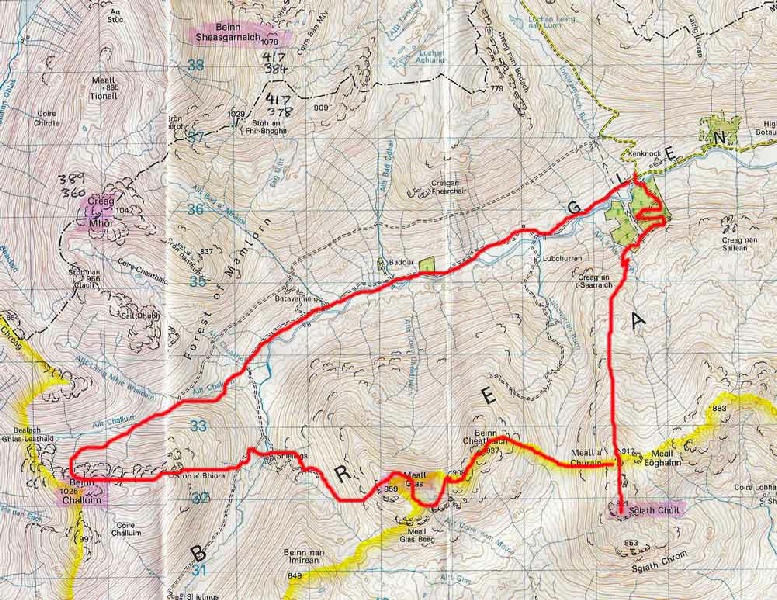
The Mamlorn Hills surround the westerly end of Glen Lochay. Five of the Munros in
this area form a natural cradle around the head of the Glen and there is a significant
drop in height between each peak ensuring a steep descent and then climb to reach
the next peak. I had hoped to follow in the footsteps of Martin Moran and do all
5 peaks in one expedition as he had done during his Winter traverse of the Munros.
However the threat of darkness forced a re-
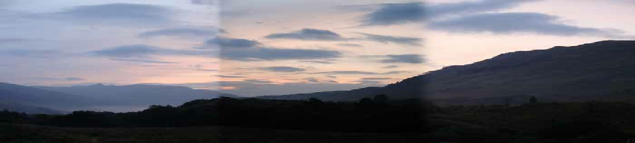
Glen Lochay was completely new territory
for me and along with Glen Lyon forms a very attractive area with a wonderful remote
feel that comes highly recommended for exploration.
|
Sgiath Chuill |
921m/3022ft |
| |
|
Meall Glas |
959m/3146ft | ||
|
Ben Challum |
1025m/3363ft | ||
|
|
|
|
|
|
date climbed |
25/09/08 |
time taken |
9 hours |
|
distance |
30km |
ascent |
1900m |
|
OS Map |
Landranger 51 |
Weather |
Poor visibility in morning then fair in the afternoon |
|
Starting point : Glen Lochay near Kenknock farm GR 466 364 | |||
|
After driving round to Killin and along Glen Lochay, the car was parked on the rough ground at the head of the Glen. The route description given on Steven Fallon's excellent Munro site was used to help guide me across the River Lochay and on towards the first summit of the day. Going was wet and boggy as height was gained on the heathery ground. Eventually a path appeared and this was followed to the summit of Sgiath Chuill and the fine views of Ben More. After retracing my steps, the very steep and pathless descent lead to the wide bealach. The ascent of Beinn Chealthaich was taken directly and then the ridge followed to Meall Glas. The descent to the track below Meall Glas was long, steep and craggy and I was glad of a refreshment stop when finally this down hill section was over. Wet grassy slopes eventually lead to Ben Challum's summit and the decision point to turn back down Glen Lochay rather than attempt to complete the other two Munros. The long walk down the Glen however was made even more pleasant by the sight of a deer herd grazing on the grass near the river. |
|
Creag Mhor |
1047m/3435ft |
| |
|
Beinn Heasgarnich |
1078m/3537ft | ||
|
|
| ||
|
date climbed |
26/09/08 |
time taken |
5 hours |
|
distance |
20km |
ascent |
1250m |
|
OS Map |
Landranger 51 |
Weather |
Initially fair with generally good visibility but thick mist later |
|
Starting point : Glen Lochay near Kenknock farm GR 466 364 | |||
|
The realisation that the days were getting a lot shorter forced the decision to try
and increase my speed on the mountains. For the past 10 years I have using Meidl
Burma boots and very fine they have been too. There are a bit heavy so I purchased
a pair of Innov8 Roclite trail shoes to see if lightening the load on the feet would
add some speed. I finally decided that this was the time to try them out so there
I was back in Glen Lochay the next morning shod with my new trail shoes. The initial
part of the walk was the reversal of yesterday's return route and was completed in
no time at all with a mixture of jogging and fast walking. So far so good. Creag
Mhor forms the confluence of three distinct ridges and was approached by the steep
but satisfying ascent of Sron nan Eun. Beyond the summit the rocky descent to the
col between the peaks was then accomplished. After climbing the west ridge of Heasgarnich
an easy walk lead across to the summit. Cloud at this point necessitated the careful
use of the compass so as not to miss the summit cairn. The descent back to Glen Lochay
was a joy with plenty of heather and soft ground to cushion a fairly rapid running
descent. This was followed by a jog down the hydro road back to the car. As for the
shoes - |

|
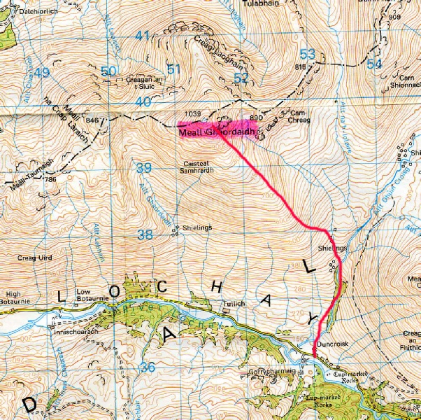
Meall Ghaordaidh |
1039m/3409ft |
| |
|
|
|
|
|
|
date climbed |
Afternoon 30/06/2012 |
time taken |
4 hours |
|
distance |
4.5m |
ascent |
825m |
|
OS Map |
Landranger 51 |
Weather |
Very poor visibility and strong winds |
|
Starting point : Duncroisk in Glen Lochay | |||
|
Meall Ghaordaidh was a fairly high gradual but gentle climb with some boulders near the summit. A track lead to the start of the path to the summit. The ascent was very wet but
the Meidl boots did there stuff as always by keeping the water out. The ground steepened
towards the top and became more rocky underfoot. The summit cairn was reached and
the circle of rocks was welcome shelter from the wind to enable a snack stop and
to share a drink of brandy and port offered by a fellow Munro bagger from Derbyshire.
|