Cordillera Blanca
|
Day 1 Bus journey to Huaraz The bus journey to Huaraz was one of many contrasts. As I left the relative wealth of Lima, I passed through the numerous shantytowns that surround the sprawling capital. The city finally fades and gives way to desert. Despite being next to the Pacific coast, the drive north will takes you through land deprived of water and vegetation. The character of the countryside changes gradually as the bus gains altitude and swings slowly East towards Huaraz, the capital and heart of "Andinismo". Although never flush with greenery, plants become more apparent as altitude is gained and the Andes draw closer. Villages become more frequent as the rivers and irrigation make farming possible. Huaraz at over 10,000ft, is a bustling town with an economy largely based on agriculture and mountaineering. |
|
|
Day 2 Start of Santa Cruz trek Cashapampa to Laguna Ichiccocha (3,600m) This is arguably the most beautiful walk in all Peru. The path initially follows an aqueduct East to the entrance of the Quebrada Santa Cruz. Passing through a large wooden gate, the path was followed along the left side of the valley. The path gradually descends to join the river which will be followed to the campsite. Time: 6 hours. |
|
|
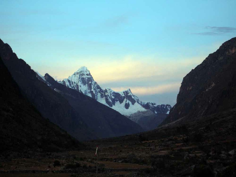
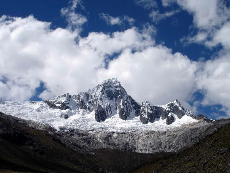
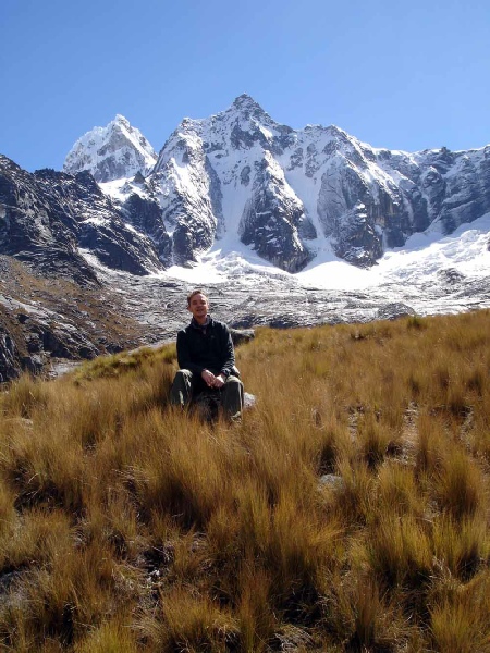
Day 3 From Laguna Ichiccocha to Taullipampa (4,200m) The trail continued to Laguna Jatuncocha and a swampy plain beyond. Having crossed a stream, we reached a dry plain. Continuing up the right side of the valley through quinoa groves and crossing a log bridge, we eventually arrived at the site of the base camp used for ascents of Alpamayo (5,947m) and Quitaraju (6,040m). We walked further up the valley, to a campsite dominated by views of Artesonraju (6,025m), Taulliraju (5,830m) and Punta Union which we will cross the next day. Time: 6 hours. |
|
|
Day 4 Cross the pass of Punta Union (4,750m) We crossed the pass of Punta Union (4,750m) on our way from Taullipampa (4,200m)
to Quebrada Paria (3,800m) - |
|
|
Day 5 Quebrada Paria to Morococha Lakes (4,400m) The walk continued down the Quebrada Huaripampa on the left bank of the river. We will crossed the river several times before entering the valley of Quebrada Morococha and climbing steadily up towards our campsite for the night. Time: 6 hours. |
|
|
Day 6 Morococha Lakes to Quebrada Demanda (3,900m) Though a road now crosses the Portachuelo Llanganuco Pass (4,750m), we walked over
it into the Llanganuco valley. The trail lead up to the pass through quinoa forests
and meadows before opening out as we approached the top. The lovely Llanganuco valley
then came into view. You could also the east flank of Huascaran with both North and
South peaks providing the backdrop to a vista that will include the Huandoy group
(6,395m), Chopicalqui (6,354m) and the awe- |
|
|
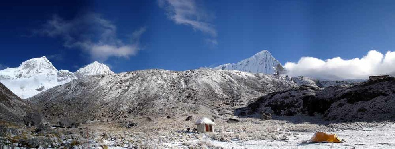
Day 7 Move to Nevado Pisco base camp (4,400m) The walk to Pisco base camp was steep and difficult in places. The small trees and forests provide some cool shade until the altitude provides a coolness of its own. The path meanders from the valley floor, crossing several rivers, before ascending the hillside. Finally, the sparse trees gave way to an open valley at the head of which we will found our camp for the night. The head of the valley is dominated by a large moraine, which bounds the right flank of the Huandoy glacier. Time: 4 hours. |
|
|
Day 8 Climb to camp 1 (4,850m) The path took us straight up the steep moraine. Once on the crest, we walked along the top facing towards Huandoy before descending steeply down the other side and on to the boulder covered glacier below. Camp 1 was located amongst boulders beside a small mountain lake at the tip of the Pisco glacier. Time: 3 to 4 hours. |
|
|
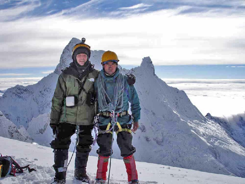
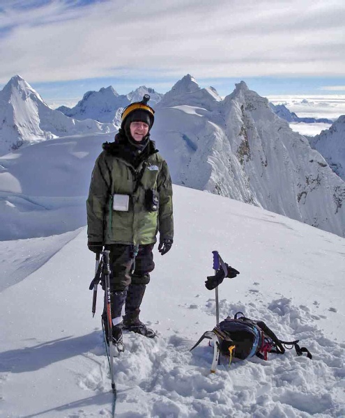
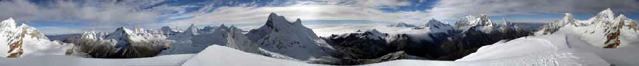
Day 9 Summit day, Pisco Oeste (5,752m) The glacier was gained just beyond the lake and followed without difficulty to the
Huandoy- |
|
|
Day 10 Descend to Pisco Base Camp and by road to Yungay We retraced our steps back to base camp and down into the Llanganuco valley. |
|