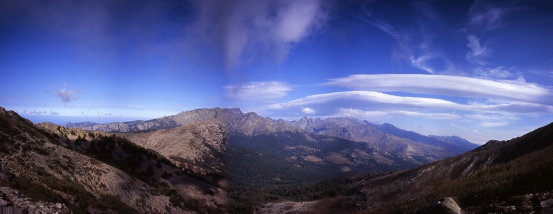
Corsica GR20
|
GR 20 Corsica 3- |
|
|
The GR20 has been founded on a series of paths and tracks used by mountain shepherds
and their livestock. The route was the inspiration of the late mountaineer, Michel
Fabrikant. The GR20 runs from Calenza in the north- The excellent guide "GR20 Corisica - Trip members were Peter and David. | |
|
Tips for the GR20
A video of the trip has been produced which would help enormously anyone planning to walk the GR20. Please email David if you want a copy. (nominal £10 charge to cover costs and postage.) A shortened version is shown below. |
|
|
|
|
|
Stage 1 Calenza to Refuge d'Ortudi u Piobbu After a good nights rest in the Muncipal Gite d'Etape, we set off in the dark through Calenza heading for the red and white flashes of the GR20. As we started to climb above Calenza, the sun rose and we came across the first of the many laricio pines that we would pass on our way to Conca. The path rose steadily as we acclimatised to the weight of the packs on our backs. We were now becoming accustomed to the ways of avoiding potential scratches from the maquis, a mixture of cistus and spiney broom plants. The path was well graded and marked at all the crucial turning spots. We soon got into the habit of stopping to make sure we were following the flashes if we had not seen one in the previous 3 minutes. Our first stop, the grassy gap at the Bocca a u Salta, was reached after about 3 hours. At this point we were caught up by a group of Germans who became companions for the rest of the trip. The next section of the route included the first easy scrambling. Loose wires were provided for assistance but were not needed. The uphill scrambling lead to the lunch stop at the Bocca a u Bassiguellu. The final section of path to the Refuge includes a rugged little climb but nothing too steep. Our decision to camp on the GR20 was made as we waited at the Refuge for the Warden to appear. A group of very loud and rather offensive walkers arrived at the refuge and proceeded to grab all the spare beds without asking the Warden as per instructions on the wall. Tenting it was then! Time : 8 hours |
|
|
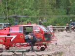
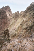
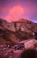
Stage2 Refuge d'Ortudi u Piobbu to Refuge de Carozzu The path from the Refuge started with a series of steep and bouldery slopes covered with trees. The head of the valley, the Bocca Piccaia was reached after about 2 hours. The guide book states you will be rooted to the spot as you reach the gap and now we could understand why! The view of the mountain scenery ahead was truly inspiring and very exciting. The next section of the route traversed the rim of the col and wound its way through boulder fields. At this point we joined by a number of dogs who seemed to coming along for the ride. Enquires with our fellow walkers confirmed they were strays, out for the rich picking from the GR20ers. One dog in particular seemed to take a liking to our party and trotted along with us for a large part of the day. The amazing pinnacles and rock towers around the Ladroncellu valley were a constant feature for most of the day but we were soon leaving them behind as we descended towards the Refuge. This was our first taste of the knee wrenching descents that are typical of the latter part of a GR20 day. During the descent, the dog who had been following us was discovered on the path, injured and bleeding. Not wanting to leave it there to die, one of the Germans volunteered to carry the dog on his back down to the Refuge, where later that evening,it was given a helicopter rescue to a vets in Calvi! Evenings at the Refuges were a great time to get to know our fellow walkers. We met a very determined group of women from the Basque country who entertained the Refuge with their wonderful singing. Time 6 hours |
|
|
Stage 3 Refuge de Carozzu to Haut Asco Early in the day, the footbridge across the Ruisseau de Spasimata was reached. The guide says it is a wobbly bridge and we would agree with this description. Pete and myself found the bridge to be the most hair raising bit of the whole GR20 and we were glad to reach solid ground on the other side. The Spasimata slabs above the bridge were dry and their ascent presented no problems. The path contours across the valley and somewhere along this stretch of path I lost my beloved Yashica T4 camera. If anyone found one around this time its mine! A steep ascent lead to the Bocca i Stagni and the news from a French party that a storm was due to arrive tomorrow afternoon. Another long descent lead us to the ski resort of Haut Asco and a welcome beer. During a training session on the South West Coast Path in Cornwall, I had a chance meeting with an American, Rick, who was planning to do the GR20 at a slightly earlier time than us but in the opposite direction. We had calculated that we would cross somewhere near Haut Asco and there, low and behold, Rick had arrived in Haut Asco. He was full of enthusiasm for the route having had a brilliant experience on the GR20 and was really helpful in providing local knowledge for the rest of our trip. Time 6 hours |
|
|
Stage 4 Haut Asco to Bergeries de Ballone With the weather threatening to close in, we decided to get a very early start to ensure we were across the Cirque de Solitude before the rain started. The path to the Cirque was gently uphill until the final steep approach to the rocky gap above the Cirque. The descent into the Cirque was no problem with the help of chains provided. The rock scenery is intimidating, made even more so by the approaching dark storm clouds but thankfully we made the ascent out of the Cirque before the weather closed in. With the major scrambling problem of the GR20 completed, we made our way down the rocky descent to the Refuge de Tighjettu, at which point the rain started. With little camping available at the Refuge, we decided to descend to the Bergeries de Ballone where a good campsite was found with great food being produced in the Refuge that evening. Time 7 hours |
|
|
Stage 5 Bergeries de Ballone to Hotel Castel de Vergio The storm lasted most of the night and into the next morning but the trusty Terra Nova tent kept us dry. We delayed our start to let the weather clear up, but with little sign of this happening we set out for the Refuge De Ciottulu di I Mori and Hotel Castel di Vergio. This was definitely the weather low point of the trip with torrential rain, thunder and lightning. Streams that were previously a trickle now became torrents and difficult to cross. With the help of fellow walkers we safely crossed the strongest stream only to hear later than a walker following us had been swept away and was severely shaken but fortunately not seriously hurt. By the time we had reached the Refuge de Ciottulu di I Mori, the rain had cleared and we started the drying out process. The Golo valley below had some wonderful laricio pines and the descent by the river through the valley after the rain storm was one the highlights of the trip. The campsite at Hotel Castel de Vergio will win no prizes for prettiness but the food in the restaurant was excellent. Time 7 hours |
|
|
Stage 6 Hotel Castel de Vergio to Refuge de Manganu A good path zig zags up through tall beech trees to the Bocca San Pedru. We stood for a long time enjoying the wonderful view back across to the mountain terrain and the Golo valley already covered by our walk. The day turned out to be a relatively easy and we were soon at the very pleasant spot of Lac du Ninu. The Bergeries de Vaccagha had been recommended for their cheese so we bought some on our way past to the Refuge. The Refuge de Manganu was definitely a place to camp. The Refuge turned out to be a pretty miserable affair and the Warden not particularly welcoming. Time 5 hours |
|
|
Weather forced rest day The weather closed in again during the night with strong winds and driving rain. When we emerged from the tent in the early morning we decided to stay put for the day and let it blow over. Some intrepid souls did carry on but we heard later that they got severely bashed around and one of the party was injured during a fall. Problems with this strategy included the overcrowding in the Refuge, putting up with the abuse from the Warden and the boredom. By late evening the weather appeared to be clearing and the rain had stopped. |
|
|
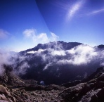
Stage 7 Refuge de Manganu to Bergeries de Tolla The day dawned clear and fresh, so with spirits revived we set off for the highest point on the GR20. The path climbed the valley behind the Refuge de Manganu to reach the Breche de Capitellu at 2,225m (7300ft). The path to the narrow rocky gap is steep in places and quite stoney and bouldery but the view when the gap was reached was amazing. Patches of mist lay in the corrie below us and two deep blue lakes were glistening in the sun as it penetrated the mist. It was definitely worth waiting for a clear spell in the weather to witness this magnificent scene. The route then cut across the steep and rocky slopes of Punta a e Porta and then onto the southern side of the ridge. Following the signs to Petra Piana, we clambered over huge boulders on the slopes of Punta Muzzella and up to the Bocca Muzella gap. The path descended to the Refuge de Petra Piana where the advice of the Warden was sought about the weather. We had intended to take the high level Alpine variant for the next sections of the route. However, after a warning from the Warden that the impending thunderstorm would make this route very dangerous, the low level route as taken. The steep descent from the Refuge was followed by a gentle walk through a valley
clothed in laricio pines. We stayed at the Bergeries de Tolla and indulged in definitely
the best food of the trip - Time 7 hours |
|
|
Stage 8 Bergeries de Tolla to Vizzavona An early start saw us on the trail to the Refuge l'Onda in good time. The weather on this morning was the best yet, with a fantastic quality of light. We ascended through a valley of beeches and reached the Refuge for a morning break. The long ascent to the crest near Punt Muratello at 2,100m (6890ft) started behind the Refuge and continued for about 2 hours . The descent from the this crest to the bar at the foot of the Cascades de Anglais was unremitting and seriously tested our patience but the coke at the bar tasted all the better for it. A broad forest path lead to Vizzavona which was reached after a very close encounter with a rather bad tempered and dangerously horned cow. We stayed in one of the dormitories at the Hotel Restaurant I Laricci and enjoyed a great evening meal in the hotel restaurant. Time 7 hours |
|
|
Stage 9 Vizzavona to Boca di Verdi The day started with the long climb through the forested slopes above Vizzavona. The views of Monte d'Oro from the Bocca Palmente were wonderful and it was a great feeling to be setting off on the GR20 South, the GR20 North well and truly under our belts. The path continued to contour round forested tracks amongst the beeches and pines. A road was crossed and then lunch taken at the Refuge d' E Capanelle ski resort. The path to Bocca de Verdi from the refuge rises and falls gently and follows the contours across the forested mountainsides. Time :10 hours |
|
|
Stage 10 Boca de Verdi to Refuge d'Usciolu The path from the Refuge lead directly to the start of the climb up to the Bocca d'Oro. At this broad and stoney gap we got our first view of the eastern coastal plain and one of our last views of Monte d'Oro. After the gap, we passed the Refuge de Prati. Facilities here had already stopped for the winter and the Warden had descended. The ridge above the Refuge was ascended and then followed for a greater part of the rest of the day. Sloping slabs of rock were crossed at some points and worn and stoney paths in beech woods at others. The summit of Monte Formicula was finally reached and then we descended to the Refuge d'Usciolu . The wind was stiffening when we arrived but we didn't think anything of it as we set up the tent. By the time the tent was erected the wind was so strong that it was difficult to stand up, so as to ensure the tent didn't get damaged we booked into the refuge for the night. Time : 8 hours |
|
|
Stage 11Refuge d'Usciolu to Refuge d'Asinau The rugged Arete a Monda was followed as it lead us over a series of rocky ridges and notches to open beech woods. After leaving the woods, the walk across the relatively flat Plateau du Cuscione gave a welcome relief from the hard rocky surfaces we had encountered on most of the other parts of the GR20. Across the plateau, the climb to the top of Monte Incudine started with a series of bouldery wooded slopes then open area of scrub and then finally bare rock. The path rose steadily along the crest to the summit, where we enjoyed the view and tried to work out the route around the spires of the Aiguilles de Bavella across the valley. The descent to the Refuge d'Asinau was long and slow but thankfully, much to the relief of our knees, it turned out to be the last big GR20 descent. Time : 8 hours |
|
|
Stage 12 Refuge d'Asinau to Refuge d'l Paliri After leaving the Refuge, the flashes were followed to the sign for the GR20 Alpine Variant. The Aiguilles de Bavella Variant is highly recommended and is not to be missed unless time is at an essence. The familiar red and white flashes were left behind for yellow flashes and the steep path taken uphill. As we gained height, the scale and wonder of the rock faces on the Aiguille de Bavella became clear. The scene, with the mist swirling below us through gaps in the mountains and the sheer rock faces around us, was another truly memorable moment on the trip. A series of rugged but not serious scrambles weaved a path through the rock spires until the main GR20 route was joined and the short section of road lead to the Col de Bavella hamlet and the day trippers out to experience the wonders of the mountains. Now, it really felt like we were nearing the end. Good tracks and paths lead us up the climb towards the Refuge. No cooked food was available at the Refuge. Time : 7 hours |
|
|
Stage 13 Refuge d'l Paliri to Conca In order to make sure we arrived in Conca with plenty of time for the bus, we set off before dawn, headtorches at the ready. The intensity of the mountain scenery continued until almost the end of the walk and it was only after we were safely on the road in Conca that you could feel your body relax without the worry of a twisted ankle or worse. The day started with a glorious dawn, as we made our way through forest. Even at this stage there was still some climbing, sometimes on bare rock or sometimes on a stony path. Eventually, the narrow cleft of the Bocca d'Usciolu came into view. It was quite an emotional moment to come through the cleft and leave the mountains behind and see the village of Conca come into view. The path lead down through gnarled cork oaks to the last GR20 red and white flash and the road junction into Conca. Time 6 hours |
|
|
The GR20 had been more than just a walk. It was an experience to be savoured to the full. It provided excitement, wonder and memories to be treasured. We just didn't walk the GR20 we lived it and it will always be part of our lives. | |
|
Getting there Air France - Taxi- |
|
|
Guide Books and Useful Sites GR20: Corsica The High Level Route by Paddy Dillon |
|
