Glencoe
After leaving the car-
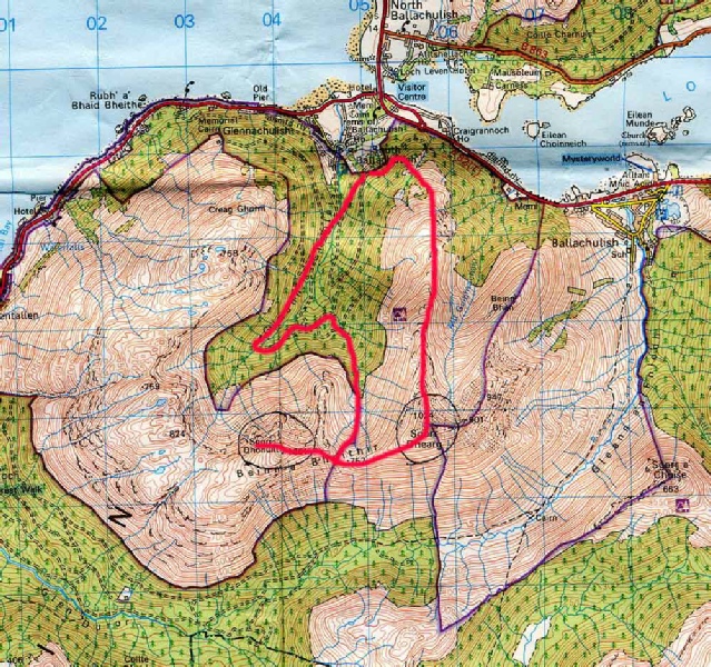
A walk to repeat in order for me to savour the view s into Glencoe, Glen Etive and across to Mull.
|
Sgorr Dhonuill Beinn a'Bheithir (Sgor Dearg) |
1001m/3284ft 1024m/3360ft |
| |
|
date climbed |
Morning 28 June 2012 |
time taken |
6 hours |
|
distance |
10 miles |
ascent |
4000ft 1220m |
|
OS Map |
Landranger 41 |
Weather |
Rain with some broken mist on the top |
|
Starting point : A828 near Ballachulish | |||
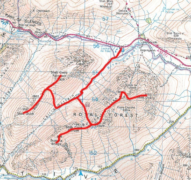
I was really looking forward to the ascent of the Buichaille. I had climbed one of the ridges to the summit during a school Fell Walking Club trip to Glen Coe in 1976 but I was pretty certain I had not climbed Stob na Broige at this time. The ascent of the Buichaille was combined with climbing the two Munros facing the Buichaille, Stob Coire Raineach and Stob Dudh. Again I was accompanied on the walk by Richard and we made good time together over the hills.
|
Buichaille Etive Mor (Stob Dearg) Stob na Broige Stob Coire Raineach Stob Dudh |
1021m/3350ft 956m/3136ft 925m/3035ft 958m/3143ft |
| |
|
date climbed |
30/5/2013 |
time taken |
6 hours |
|
distance |
10 miles |
ascent |
4000ft 1220m |
|
OS Map |
Landranger 41 |
Weather |
Good visibility and some sun |
|
Starting point : A828 near Ballachulish | |||
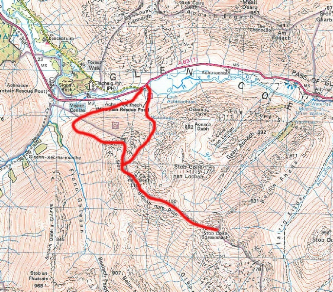
Having met Richard in the Youth Hostal in Crianlairich, we decided to team up to
complete the Munros on the southern side of Glen Coe. This we did over two days,
the first being the ascent of Bidean nam Bian and Stob Coire Sgreamhach. We did not
find the path at the outset in the Glen but went our own way up the western end of
An t Sron on a grassy but well paced ascent to the higher peaks. Stob Coire nam Beith
was reached in good time ready for a mid-
|
Bidean nam Bian Stob Coire Sgreamhach |
1150m/3773ft 1072m/3517ft |
| |
|
date climbed |
29/5/2013 |
time taken |
6 hours |
|
distance |
10 miles |
ascent |
4000ft 1220m |
|
OS Map |
Landranger 41 |
Weather |
Rain with some Broken mist on the top |
|
Starting point : A82 near the mouth of Loch Achtriochtan GR 139567 | |||