Inverlael Munros
The Inverlael Forest lies south-
|
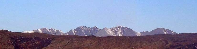
Seana Bhraigh |
927m/3041ft |
| |
|
Eididh na Clach Geala |
927m/3041ft | ||
|
Meall nan Ceapraichean |
977m/3205ft | ||
|
Beinn Dearg |
1084m/3556ft | ||
|
Cona' Mheall |
978m/3209ft | ||
|
date climbed |
7/05/2012 |
time taken |
12 hours |
|
distance |
23miles |
ascent |
7100ft 2160m |
|
OS Map |
Landranger 20 |
weather |
wintery showers but generally good visibility |
|
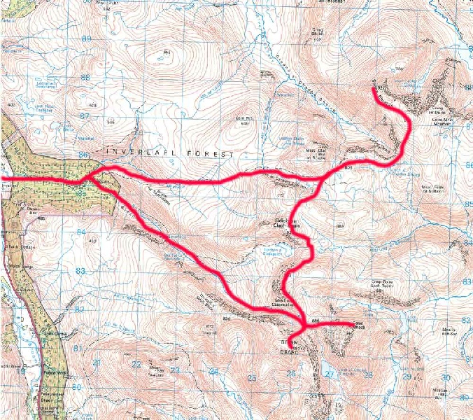
Starting point : Inverlael |
|
|
|
The Forest Way bunkhouse was left early in the morning so as to ensure a good early
start on the walk. The car was left at the Inverlael walkers car park and the track
taken into the forest. The Steven Fallon guide to the route was followed and a bulldozer
track lead out of the forest and up onto the fell to connect with the stalker path
network. The route to Seana Bhraigh followed a good stalker's path for a fair way,
giving out when the terrain became complex. Fortunately there was good visibility
at this point so it was relatively easy to work the way though towards the summit
of Seanna Bhraigh. Great views again from the top. After retracing my footsteps, the
ascent of second peak of the day, Eididh na Clach Geala, was a straight forward affair.
There was however a big drop and steep ascent of Meall nan Ceapraichean following
to compete the third peak of the day. Beinn Dearg is considerably bigger than the
other peaks and the destitution wall lead almost the summit. This was the most heavily
snow covered area of the route and was most easily retraced by sliding down on my
backside. The final peak of the day Cona' Mheall was approached by an indistinct
path which lead through the rocky outcrops at the base of the hill. The ascent was
celebrated with a bite to eat and then it was time to re-
|
Am Faochagach |
954m/3130ft |
| |
|
date climbed |
8/05/2012 |
time taken |
3 hours |
|
distance |
9 miles |
ascent |
2474ft 754m |
|
OS Map |
Landranger 20 |
Weather |
very misty |
|
Starting point : A835 NW end of Loch Glascarnoch | |||
The ascent of Am Faochagach was a very a straightforward climb with the only potential complication being the crossing of the Abhainn a' Gharbhrain river. Although fairly full, there were enough big stones available for aid to avoid getting wet feet at this point. The summit hogsback was a very wintery affair shrouded in mist and with quite deep snow. It was unfortunate not to get view back from the summit to the hills I had climbed on the previous day.