John Muir Trail 2010
|
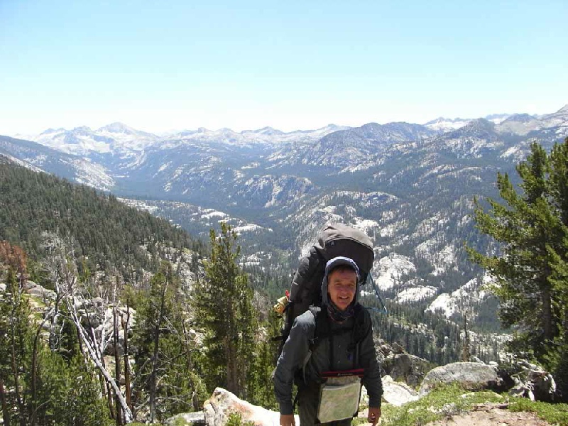
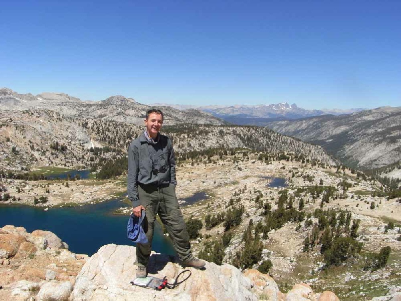
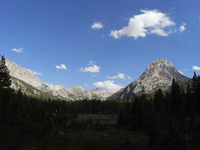
The John Muir Trail The John Muir Trail, named after the famous early environmentalist, runs along the spine of the Sierra Nevada range of mountains in northern California. The route stretches 211 miles from the Happy Isles trailhead at Yosemite to the summit of Mount Whitney. Most people only tackle sections of the trail, mainly in the north, where entry and exit are easiest. The northernmost sections from Yosemite are the most popular and therefore most crowded. The beautiful Sierra Nevada were referred to as the "Range of Light" by John Muir, and contain an incredible diversity of scenery. This is many peoples' favourite hike anywhere in the world. The trek is of varying heights, taking between 2- The trail reaches 4,421m at the top of Mount Whitney, and averages a bit over 3,000m. The excellent guide, "The John Muir Trail" by Alan Castle, was used for the expedition and is highly recommended. David did the trip as a solo expedition. Further pictures are here. A DVD of the John Muir Trail is available. | |
|
Tips for the JMT
There are masses of websites that give a huge amount of information on how to get
permits, what food to take and re- A video of the trip has been produced which would help anyone planning to walk the John Muir Trail. Please email David if you want a copy. (nominal £10 charge to cover costs and postage.) |
|
|
| |
|
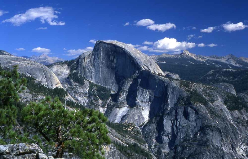
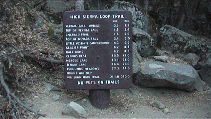
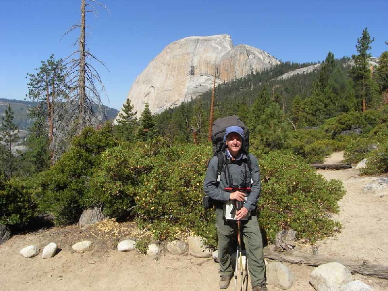
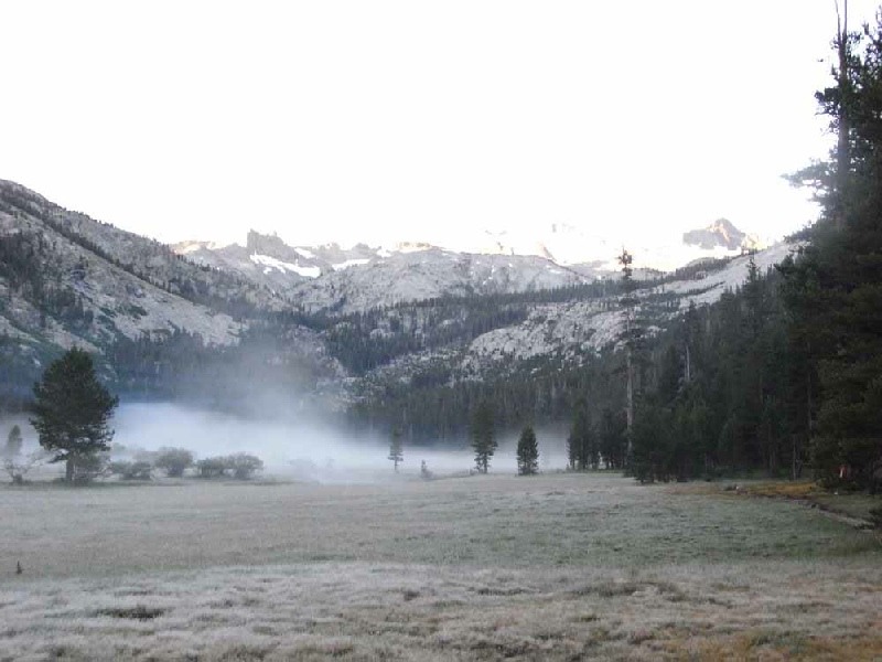
Day 1 Happy Isles to Sunrise High Sierra Camp Total distance of day 19 miles Total ascent of day 6000ft After a good night's rest at the Backpackers Campsite in Yosemite, I set out on the road to the Trail Head. The sign at the beginning of the John Muir Trail was photographed and then it was "heads down" for the next two hours, whilst climbing to the top of the Nevada Falls. The pack felt heavy but I was managing. Having climbed Half Dome on a previous occasion, I carried straight on at the junction of the path towards Sunrise Creek. At this point I made the only navigational error of the JMT when I carried on up the Clouds Rest path for some time before realising my mistake and retracing my footsteps. It was a long day and it was after 6 in the evening before I made the Sunrise Sierra Camp and set up my tent. |
|
|
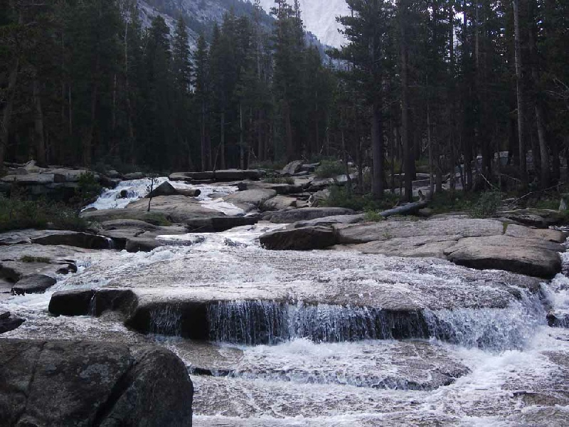
Day 2 Sunrise High Sierra Camp to Upper Lyell Canyon Total distance of day 19 miles Total ascent of day 1600ft The first night was surprisingly cold and I woke to find my water bottle frozen and the tent lined with frost. I got into the routine of an early start, waking at 4:45 with the aim of getting on the trail by 6 in the morning. This is a pattern I kept to for most of the Trail and it worked very well. The first part of the day involved climbing Cathedral Pass and then dropping down to Tuolumne Meadows. The Grill in the Tuolumne village does a brilliant bacon and cheese burger which helped the calorie intake enormously. A very pleasant afternoon was spent walking along the Lyell Fork River until the path started to climb which is where I camped for the night. |
|
|
Day 3 Upper Lyell Canyon to Ruby Lake Total distance of day 12 miles Total ascent of day 2500ft Upper Lyell Canyon has a bad reputation for problem bears but thankfully no bears
were seen during the night. The initial part of the day included the ascent of the
first serious mountain pass of the JMT, the Donohue Pass. The view from this pass
was stunning and gave a window into the joys to come further along the trail. After
a inconsequential second pass of the day - |
|
|
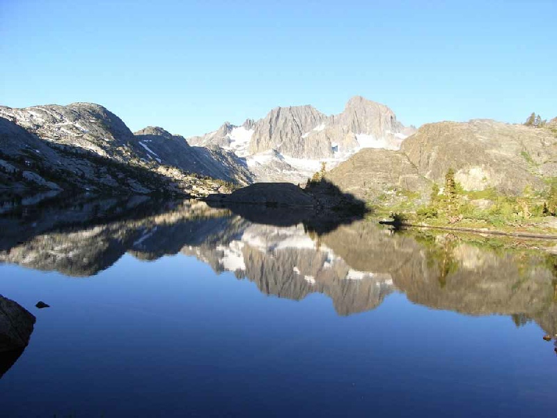
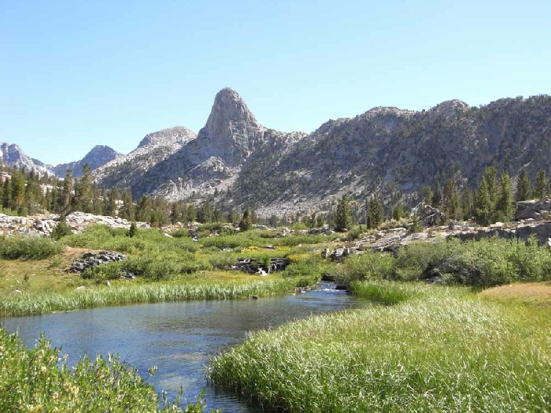
Day 4 Ruby Lake to Reds Meadow Resort Total distance of day 18 miles Total ascent of day 2000ft The day was a joy with the JMT threading it's way through some of the best mountain/lake country on the whole of the Trail. Garnett Lake was passed early in the morning with its amazing surrounding mountain views of the Ritter range. Shadow Lake was then passed again with stunning reflections in the crystal clear water. A long wooded descent finally saw us down to the Devils Postpile National Monument and the wonderful basaltic column sculptures. Reds Meadow Resort was the next port of call with the very welcome hot spring showers and the excellent restaurant. |
|
|
Day 5 Reds Meadow Resort to Purple Lake Total distance of day 14 miles Total ascent of day 1500ft After a good breakfast in the restaurant the climb towards Deer Creek was a bit of struggle with such a full stomach but the red pumice cones added interest to the climb. An easy day with gently gradients and wide open views followed with a great camping spot near to the very picturesque Purple Lake. |
|
|
Day 6 Purple Lake to Pocket Meadow Total distance of day 12 miles Total ascent of day 2000ft The day started by climbing a gully beneath a huge broken rock face and then onwards
to Virginia Lake. The rocky landscape was replaced by a lush woodland near Tully
Hole. The next obstacle was Silver Pass which was climbed without too much difficulty
amongst some very inspiring rock scenery. The long zig- |
|
|
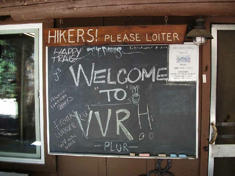
Day 7 Rest Day - Total distance of day 4 miles Total ascent of day 0ft The Trail lead gently down to Edison Lake and the pickup point for the Vermillion
Valley Resort ferry. The ferry arrived at about 9:30 in the morning and by just after
10 in the morning I was tucking into a big cooked breakfast. A day of chores followed
with clothes being washed and the food supplies sorted out. I met up with Martin,
Abi, Alison, Andrew and Daniel who had decided to spend a week at the Resort and
had kindly agreed to bring my re- |
|
|
Day 8 Edison Lake to Rosemarie Meadow Total distance of day 12 miles Total ascent of day 3350ft After the 9 o'clock ferry from the Vermillion Lake Resort, the morning was taken
up with the long climb to the top of Bear Ridge. This was under pleasant shade from
the good tree cover and the huge breakfast helped keep up the energy levels all the
way to the top. A long succession of zig- Bear Creek was then followed for many miles to Upper Bear Creek Meadows and then west onto to the good camping spot of Rosemarie Meadow. |
|
|
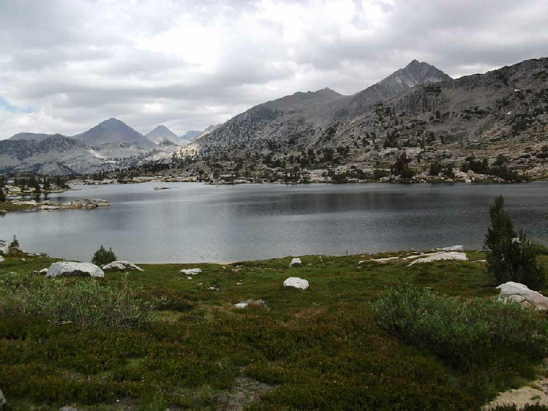
Day 9 Rosemarie Meadow to Muir Trail Ranch Total distance of day 10 miles Total ascent of day 1100ft An easy day with most of the ascent up the Selden Pass having been made on Day 8. The top of pass stands at 10,900 ft and the views of the northern section of the JMT were wonderful, stretching out as far as the eye could see. There followed a long descent to the Muir Trail Ranch. I camped near the ranch and had a relaxing afternoon preparing myself for the last 8 days of the Trail. |
|
|
Day 10 Muir Trail Ranch to McClure Meadow Total distance of day 11 miles Total ascent of day 2200ft The Trail headed southwards along the very beautiful San Joaquin Valley to enter the Kings Canyon National Park. At Franklin Meadow, a major fork in the trail was reached and the substantial ascent into Evolution Valley brought me to the river crossing at Evolution Meadow. The path on the northern bank of the river gradually climbed to the very lush McClure Meadow. A very memorable evening was spent gazing up at the wonderful panorama of the cirque of mountains. Ranger Dave introduced himself and we compared notes on the Trail and the bears. |
|
|
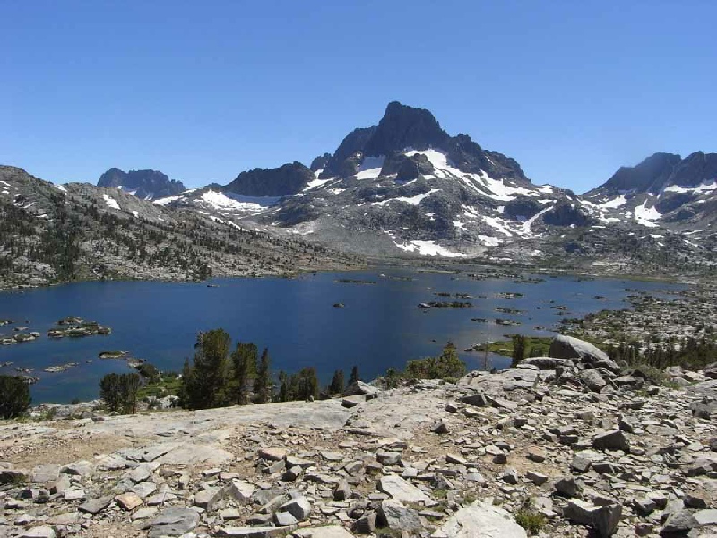
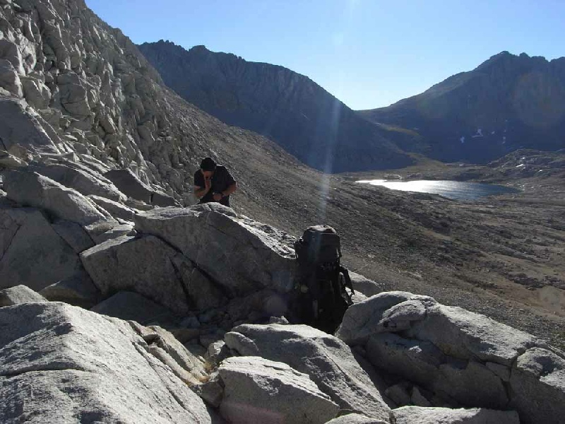
Day 11 McClure Meadow to Big Pete's Meadow Total distance of day 15 miles Total ascent of day 2500ft Today's route ascended the Muir Pass. Standing at 11995ft, this was the highest point so far on the Trail. The high point on the pass is marked by a shelter built by the Sierra Club in 1930 for only emergency use. A series of wonderfully clear lakes were passed on the way to the top of the pass including Evolution, Sapphire and Wanda Lakes. The shelter was reached and I was ready for a welcome snack stop. Jim and Jeremy introduced themselves in the shelter. We compared notes about the weight of our rucksacks and I tried to work out why I was carrying twice as much as they were ! After the pass I entered a barren, impressive and fragile high mountain landscape.
A steep descent lead to the tree- |
|
|
Day 12 Big Pete's Meadow to Upper Palisade Lake Total distance of day 12 miles Total ascent of day 2500ft The day started with the long and gentle descent down Le Conte Canyon. This area
is a true high spot of the JMT with soaring granite cliffs stretching the length
of the Canyon. At the trail junction, the JMT branched left to the east to ascend
the valley in the direction of the Mather Pass. After Deer Meadow, the zig- |
|
|
Day 13 Upper Palisade Lake to Lake Marjorie Total distance of day 11 miles Total ascent of day 2000ft The day dawned in very spectacular fashion with the remaining clouds and mist being
highlighted by the red sun of the dawn. The terrain became more rocky and barren
as the path wound its way to the top of the Mather Pass at 12,100ft. The landscape
to the south looked even dryer and austere as the path zig- |
|
|
Day 14 Lake Marjorie to Rae Lakes Total distance of day 15 miles Total ascent of day 2000ft The Pinchot Pass at 12,130ft was climbed without any great difficulty in the cool
of the morning and again there was a wonderful alpine vista waiting beyond the pass
to behold. A long descent followed to a most impressive suspension bridge. The bridge
had a very unnerving resonance when I crossed it and I was glad to get to the other
side without being catapulted into the water below. A long approach walk followed
up a wonderful valley towards our campsite at Rae Lakes. Dollar then Arrowhead Lakes
were passed to finally reach the most wonderful spot on the whole of the JMT - |
|
|
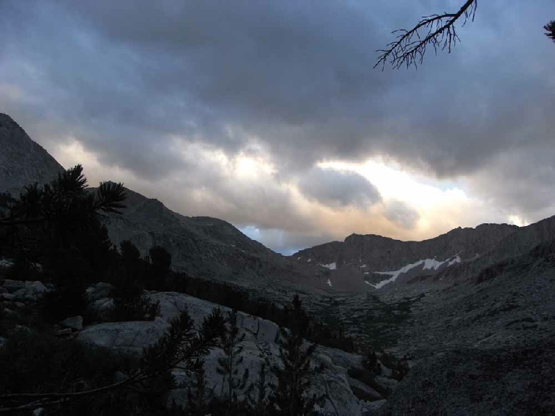
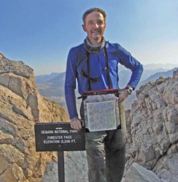
Day 15 Rae Lakes to an unnamed lake south of Forester Pass Total distance of day 18 miles Total ascent of day 6000ft This was a very big day which included the ascent of two big passes. The day started with the major and steep ascent of Glen Pass at 11,9778ft. The view back across Rae Lakes was truly memorable and will be treasured for a long long time. The gradient was easy at all times using the well engineered path but I was still glad to reach the top. A steep descent of over 2000ft followed to eventually arrive at Vidette Meadow. The next objective was the highest pass of the JMT, the Forester Pass standing at a monster 13,200ft. As the path climbed, the scenery changed from forest to an incredibly bleak rocky moonscape with no vegetation. The climb was slow but steady. At about 5:30 in the evening I finally reached the high point of the pass. I was tired, especially in my legs. There now followed the incredibly steep, engineered descent down the almost vertical face of the mountain. At the bottom of the cliff I headed into the desert like upper basin eventually deciding to camp by a small lake just off the Trail. As I sat in the porch of my tent looking out at the landscape in the moonlight the thought occurred to me that I was probably furthest away from any other human being than I had been in the whole of my life. |
|
|
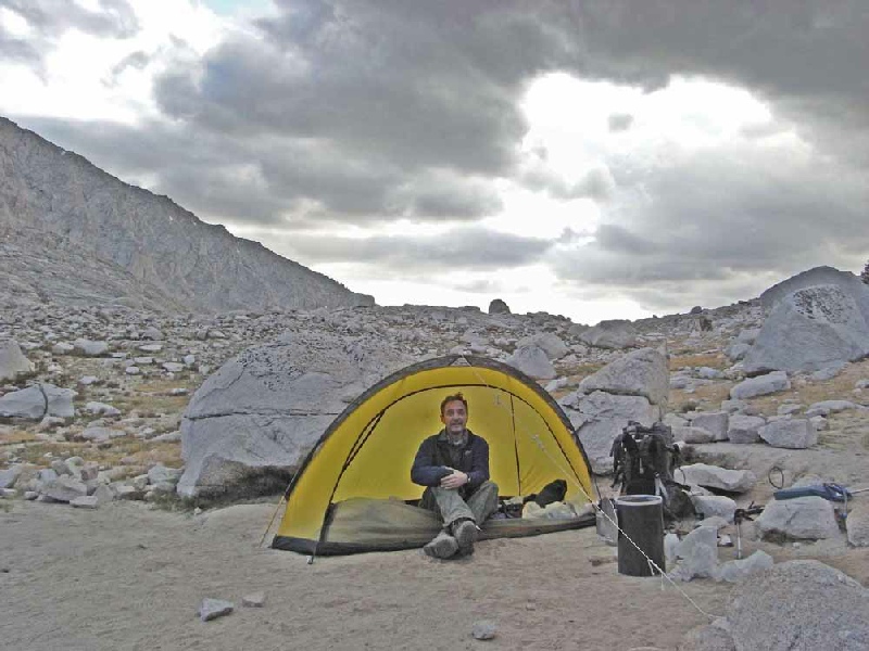
Day 16 Unnamed lake south of Forester Pass to Guitar Lake Total distance of day 14 miles Total ascent of day 1800ft It was a relief that there was no pass to cross today but a relatively gently walk to Guitar Lake, nestled under the final destination of the John Muir Trail, Mount Whitney summit. A fine mix of woods and meadows kept up the interest levels during the day's walk but I was thinking mainly about the climb of Mount Whitney and the finish below at Whitney Portal. A sign was passed indicating 8.3 miles to the top of Mount Whitney and my heart leapt at the thought of getting to the end. The number of trekkers passed was increasing all the time as I got nearer to Mount Whitney with summiteers returning from their successful expeditions. Finally Guitar Lake was reached and I set up my last camp of the JMT. |
|
|
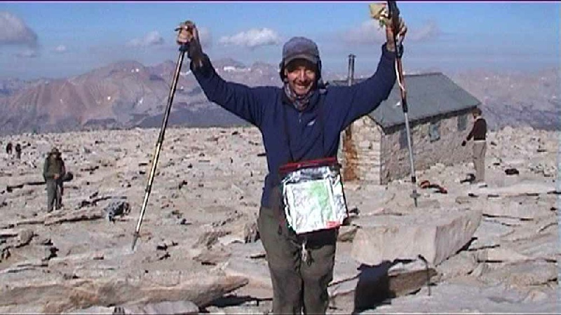
Day 17 Guitar Lake to Whitney Portal Total distance of day 17 miles Total ascent of day 3200ft I started the ascent at about 3:00 in the morning and followed the line of head torches off into the distance. The day had dawned by the time I had reached Trail Junction. At this point the rucksack was left and the final 1000ft of climbing was accomplished with a great feeling of lightness. The summit was reached and Jeremy and Jim were there as well to take my picture. The views from the top were astonishing particularly looking off into the north where I had come from all those days before. After signing the visitors book and taking a final panoramic shot of the view I started the descent. And what a descent with 2000ft of switch backs before the gradient levelled out somewhat for the remaining descent to the final destination, the cafe at Whitney Portal. The trail was complete after some of the most memorable days of my life. The practicalities of getting back to San Francisco then loomed large in my thoughts but I need not have worried since a lift with Jim and Jeremy was offered to a hotel in Mammoth Lakes and then onto a bus bound for Reno |
|
|
Guides, Maps and Useful Sites Tom Harrison Maps for the John Muir Trail The complete guide to the John Muir Trail by Alan Castle Walking in the range of light- |
|