The Pennine Way
|
The Pennine Way |
|
28rd August 2024 - |
|
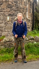
My exposure to the Pennine Way started a long time ago when I was 15. I went with my brother Peter and two other friends to do a Duke of Edinburgh expedition along about 70 miles of the Way from Malham to above Hawes. It was a quite dreadful experience. The weather was pretty wet and nasty and the terraine was terrible. Peat hags barred the way for most of the walk with huge expanses of bog. My brother went up to his waist a one point in the walk. Since then I have not really thought about doing the walk until this Summer. The Pennine Way was originally put together as a National Trail in 1969 so is over 50 years old. The fabric of the walk has changed considerably since the time when I did some of it in 1975. The most significant change has been the placement of many thousands of flagstones over the significantly boggy moorland stretches. This makes the walk so much more pleasant and has considerably increased the level of vegetation along the walk as well. In terms of my schedule for the walk I had seen a description of walk at Brian’s Walks website for completion in 13 days. I used this as a guide for my walking schedule but I took one day longer at 14 days of walking. This means I averaged about 20 miles a day and did 27 miles on two occasions including the last day out to Kirk Yethholm. I really enjoyed the physical challenge of the walk. The scenery was good as well as the company I met along the way. Highly recommended. |
|
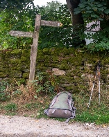
Day1 - I took the train from York to Edale station on a fine morning. Having found my way into Edale village I saw the first Pennine Way sign pointing upwards Kinder Low. The ascent of Kinder Low was not too streching and was a good warm up for the rest of the day. I came across my first section of flagstones and wondered how on earth the people who laid them down managed to move them into place. After passing Jacobs ladder I ascended to the trig point at Kinder Low. The rest of day did not involve a lot more ascent and then it was downhill to the Old House hostel and then beyond to the campsite at Crowden. |
|
Day 2 - The next day involved the ascent of Black Hill then pretty flat walking across towards Hebden Bridge. This is resevoir country. I finally pitched my tent next to the Stoodley Pike Napoleonic war memorial for an uneventful night sleep. |
|
Day 3 - I made a couple of errors this morning - |
|
Day 4 Wild camp north of Ickornshaw to Malham YHA Gargrave was the next significant town I passed through. The Coop in was a welcome replenishment stop for some supplies. I then moved on towards Malham where I checked into the YHA for the night. |
|
Day 5 Malham YHA to Hawes YHA I was now moving into the very familiar territory with the walk across to Horton
in Ribbledale. Malham Cove is always impressive to walk up the side on the wayout
of Malham. It was then on towards Fountains Fell and Pen- |
|
Day 6 Hawes YHA to Tan Hill wild camp The next day took me over Great Shunner fell then on towards Keld. The cafe in Keld was a very welcome supply of rations to keep me going. I then moved on to the Tan Hill Inn and had one of their famous massive Yorkshire Puddings with mashed potato, vegetable and meat fillings. I did not think I could possible eat it but I did and very welcome it was too. I then went onto for another couple of miles before setting up my camp in the dark. |
|
Day 7 Tan Hill wild camp to wild camp at Harter fell After Tan Hill there was a long slow descent towards Clove Lodge then a short walk
towards Middleton- |
|
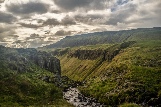
Day 8 Wild camp at Harter fell to Dufton campsite There was not a lot of climbing on the way to Dufton but before the descent into Dufton was the most dramatic scenery of the Pennine Way with the view across High Cup Nick. According to the YHA map in Malham there was a YHA in Dufton but I was dissapointed to find it had closed about 3 months ago. So I camped at Dufton campsite and decided to have a rest day to recuperate and organise accomodation for the rest of the walk. |
|
Day 9 Rest day |
|
Day 10 Dufton campsite to Alston Bunkhouse This according the Cicerone Press guide book was the toughest day of the Pennine Way. I got an early start to make sure I got to Alston in good time. The early part of the day had poor visibily on Knock Fell and Great Dunn Fell. I actually had to use my compass to help navigate toward Cross Fell since the paths were not very obvious. The mist however did clear by the time I got to Cross Fell and I got a good view across towards the Eastern Fells of the Lake District. The descent from Cross Fell towards the village of Garrigill was down a 7 mile track. This was definitely the worst bit of the Pennine Way. The rocks on the track were of the size that is made your feet really sore so I was really glad to get the end of it and move into Garrigill and then on towards Alston. |
|
Day 11 Alston Bunkhouse to Greenhead hostel There was very little climbing on this day but it was time consuming having to negotiate lots of field paths. The Greenhead hostel and the associated pub were very good. |
|
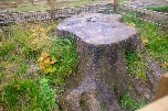
Day 12 Greenhead hostel to Housesteads B and B This day involved walking along side Hadrian’s wall for a lot of the day. There was a lot of up and down along the wall so I was glad that I split the day rather than trying to get to Bellingham in one long day. The wall is really impressive. It was very sad to go by Sycamore Gap to see the stump of the tree in the gap but it has already started to put out shoots again! |
|
Day 13 Housesteads B and B to River Dale Hotel Bellingham Again another quite flat day with little climbing. I stayed in the very nice River Dale Hotel which was quite a luxury at this stage of the walk. |
|
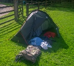
Day 14 River Dale Hotel Bellingham campsite at Byrness It really felt that I was getting towards the end of the walk at this stage. Not a difficult days walking and I set up my tent for the last time of the walk in the campsite at Bryness. I got to bed very early ready for early start the next day. |
|
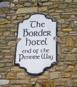
Day 15 Campsite at Byrness to Kirk Yethholm I got up at 5am and to get away early. I managed to eventually find the Pennine Way
start and was joined by two ladies - |
|
Home - |
|
|